
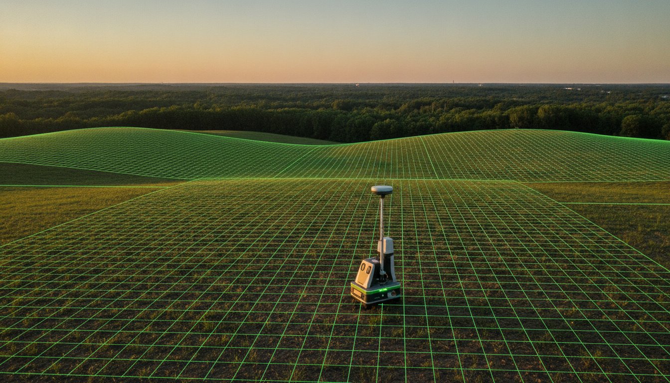
A single boundary dispute that reaches a courtroom can cost you $50,000 in legal fees. It is a massive financial burden that usually starts with a simple misunderstanding of where your land ends. You need to know exactly where your corners sit to avoid encroachments or prepare your lot for a fast sale. This guide teaches you how to check property lines using the most efficient methods available in 2026.
Locating your boundaries shouldn’t be a source of stress. You want a clear, reliable way to verify your acreage without wasting time on guesswork. We promise to show you the exact steps to identify your land limits using digital tools, physical markers, and professional resources. Follow this guide to navigate the new 2026 ALTA standards, leverage modern mapping technology, and find the physical iron pins that define your asset. We simplify the process so you can list your land or build your fence with total confidence and peace of mind.
Key Takeaways
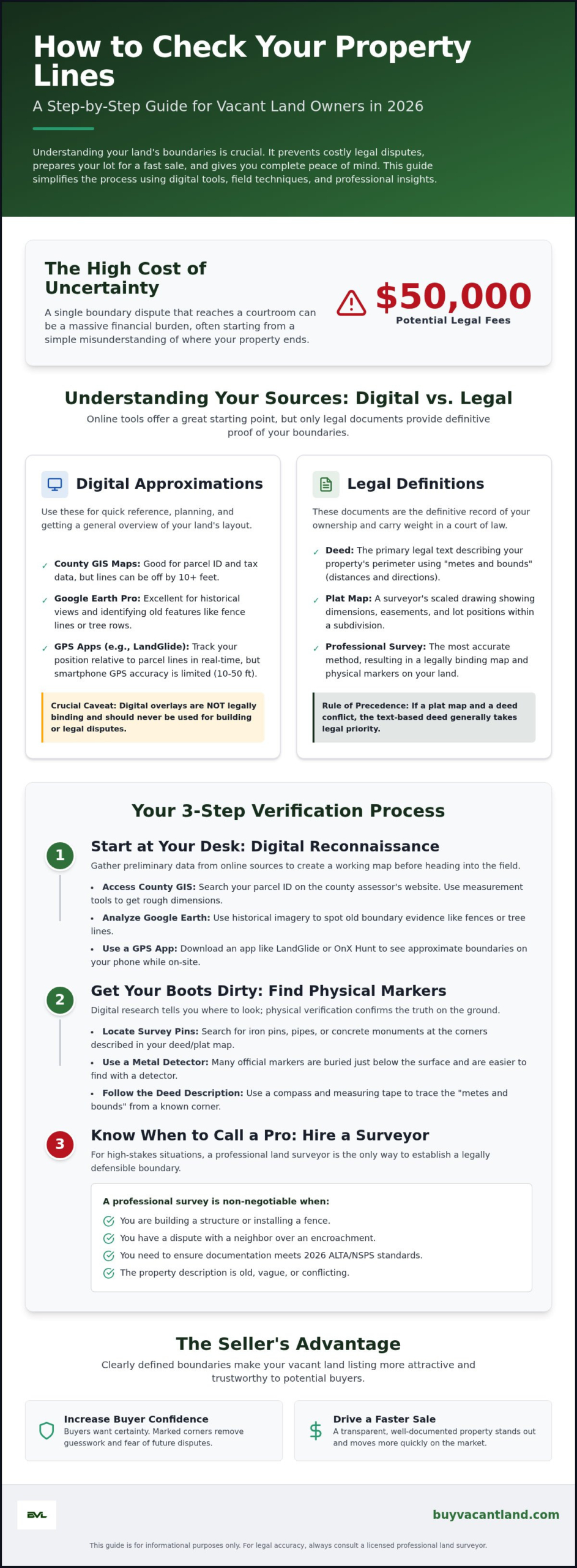
- Leverage county GIS and Google Earth to pinpoint parcel data and topographical context from your computer.
- Master how to check property lines using field techniques to find physical markers and buried survey stakes.
- Recognize the high-stakes situations where a professional land surveyor is the only way to avoid legal encroachments.
- Drive faster sales by including verified boundary data and clear photos in your vacant land listing.
- Understand the 2026 ALTA/NSPS standards to ensure your property documentation is accurate and legally binding.
Understanding Property Lines and Boundary Basics
Property lines are the invisible walls of your investment. They represent the legal perimeter of your land parcel. Understanding these boundaries is the first step in learning how to check property lines effectively. Without this knowledge, you risk building over a line or losing a sale. Many owners rely on county GIS maps. These tax maps are designed for government revenue, not for pinpointing exact corners. They are often off by several feet. A legal survey is the only document that carries weight in a court of law. It is the definitive record of your ownership.
You must distinguish between digital convenience and legal reality. Online tools are helpful for a general overview, but they lack the precision of a professional survey. If you are preparing to list vacant land, precision is your best friend. Clear boundaries prevent neighbor disputes and legal headaches. They turn a confusing asset into a transparent, ready to sell product. Knowing your limits protects your equity and simplifies every future transaction.
The Difference Between a Plat and a Deed
A plat map provides a bird’s eye view of your land. It is a visual representation created by a surveyor. It shows dimensions, easements, and neighboring lots in a clear, scaled drawing. A deed is different. It is a text-based legal document. It uses metes and bounds to describe the perimeter. This means it lists distances and compass directions from a specific starting point. If these two documents conflict, the deed generally takes precedence. This is because the deed represents the actual legal transfer of rights and property interest. Always verify the text in your deed against any visual maps you find.
Why Boundaries Matter for Vacant Land Sellers
Knowing your boundaries is a massive advantage when listing land on a marketplace like BuyVacantLand.com. It eliminates the fear of neighbor disputes. Buyers want certainty; they don’t want to guess where the hunting land or off-grid lot begins. You can increase buyer confidence by marking corners before you list. This transparency sets your property apart and drives a faster sale. It also aligns with what educated buyers look for in this 2026 beginner’s guide on how to buy land. Selling land becomes simpler when you remove the mystery of the boundary. Use these methods to provide a clear, assured proposal to every potential buyer. Identifying how to check property lines now saves you from expensive legal corrections later.
Online Tools for Digital Property Line Checks
Digital tools offer a fast start. You can begin your research from your desk. This is the first phase of learning how to check property lines without leaving home. Modern technology provides immediate access to parcel data that once required a trip to the courthouse. However, digital overlays are approximations. They are not legal proof. Use them for planning and general reference only. They provide a vital baseline before you step onto the dirt.
Google Earth Pro is a powerful, free resource for land owners. It provides historical satellite imagery. You can see how the land has changed over several decades. Look for old fence lines, stone walls, or distinct tree rows. These features often follow legal property boundaries. The 3D view shows elevation changes and topographical context. This helps you understand the terrain before you attempt to walk the perimeter. It is an essential step for evaluating raw, undeveloped land.
Accessing County GIS Maps
Every county maintains a Geographic Information System (GIS). It is a goldmine for parcel data. To start, visit your county assessor or tax mapper website. Look for an “Interactive Map” or “GIS Portal” link. You can search for your property by parcel ID, owner name, or physical address. Once the map loads, use the built-in measurement tools. These allow you to estimate acreage and boundary lengths with a few clicks. While some sources claim these tools are 100% accurate, they are often misaligned with the actual satellite imagery. A digital line on a GIS map can be off by 10 feet or more. Always cross-reference these maps with your legal deed.
Top GPS Apps for Land Owners
Mobile technology puts parcel data in your pocket. Apps like LandGlide or OnX Hunt are industry standards for land owners. They use your phone’s GPS to track your position in real-time. You can walk the property and see your icon move relative to the digital boundary lines. This is incredibly useful for navigating large, wooded tracts where landmarks are scarce. Be aware of hardware limits. Consumer-grade GPS in smartphones is usually accurate within 10 to 50 feet. This range is acceptable for finding a general area but insufficient for building structures. If you need pinpoint accuracy for a legal dispute, consult the National Society of Professional Surveyors (NSPS) to find a licensed professional.
Once you have a digital handle on your land, you are ready to move toward physical verification. Accurate digital data makes your property much more attractive to potential buyers. If you are curious about how other sellers present their parcel data, you can browse undeveloped vacant land listings to see high-quality examples. Understanding how to check property lines digitally is just the first step in protecting your asset.
Physical Methods: Finding Markers in the Field
Digital research tells you where to look. Physical verification confirms the truth. Learning how to check property lines requires you to get on the ground and find tangible evidence. Most modern surveys rely on iron pins. These are rebar rods driven deep into the earth. Over time, soil and vegetation bury these markers. You cannot rely on a visual scan alone. Use a metal detector. It is the most efficient tool for locating buried corners on raw, undeveloped land. This step moves you from guesswork to certainty.
Once you locate a marker, preserve the discovery. Use high-visibility flagging tape in bright orange or pink. Tie the tape to a nearby branch or a wooden lathe stake driven next to the pin. This creates a clear visual line for you and potential buyers. Marking your findings now prevents you from repeating the search later. It also provides an immediate sense of the land’s actual dimensions. This physical presence is a powerful tool when preparing a lot for listing.
Hunting for Survey Pins
Standard survey pins are typically 1/2 inch to 5/8 inch thick. They often feature a colored plastic cap. This cap contains the surveyor’s name or license number. Focus your search on the corners indicated by your plat map. If a pin is missing, use the “swinging a tape” method. Start at a known, confirmed corner. Use a long steel measuring tape to pull the distance listed on your deed toward the next suspected corner. Use your metal detector within a five-foot radius of that point. Pins on raw land are rarely lost; they are just hidden under a few inches of forest floor or silt.
Identifying Boundary Indicators
Look for historical or natural clues that predate modern pins. In rural areas, “witness trees” often mark corners. These trees may have distinct blazes or scars cut into the bark. Historical stone walls or old hedge rows are also reliable indicators of ancient boundaries. Utility poles frequently follow road easements or shared property lines. These indicators are especially critical when evaluating cheap land for sale, where markers might be decades old. Before heading into the field, examine a high-quality resource like the Massachusetts Interactive Property Map. It provides an excellent example of how state-level data visualizes these boundaries. Use these clues to build a complete picture of your land’s perimeter. Physical evidence is the only way to verify how to check property lines with absolute confidence.
When to Hire a Professional Land Surveyor
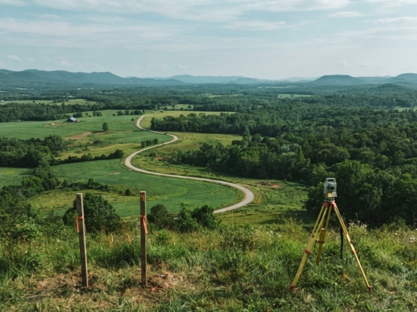
DIY methods like metal detecting or using GIS apps are excellent for internal planning. They don’t hold up in court. If you need to know how to check property lines for a building permit or a legal dispute, you must hire a professional. A licensed surveyor provides a signed and sealed document. This is the only evidence that carries legal weight. It protects your equity from encroachment claims. Hiring a professional is a strategic investment in the safety of your asset.
Don’t guess where your boundary lies when pouring concrete. A small mistake can lead to a court-ordered demolition. The 2026 ALTA/NSPS Land Title Survey Standards went into effect on February 23, 2026. Any survey conducted after this date must comply with these updated requirements. These standards improve transparency regarding encroachments and aerial imagery. They ensure your physical survey aligns perfectly with your title documents. Precision prevents future litigation.
The cost of a residential boundary survey typically ranges from $500 to $1,200. Complex projects or large parcels can drive this as high as $2,300. While this feels like a significant upfront expense, it is a fraction of the cost of a legal battle. Boundary disputes that reach a courtroom often result in legal fees between $15,000 and $50,000 per party. Paying for a professional survey is a pragmatic choice to avoid a financial catastrophe. It replaces uncertainty with a definitive, legal record.
The 3 Signs You Need a Professional
- Building permanent structures: Never build a fence, shed, or retaining wall near the line without professional staking.
- Resolving a formal dispute: If a neighbor claims your driveway or landscaping is on their land, a professional survey is the only resolution.
- Selling high-value lots: Title companies often require a fresh survey to issue insurance for residential lots or commercial parcels.
Types of Professional Surveys
- Boundary Survey: This is the standard choice for identifying property corners and lines for residential use.
- ALTA/NSPS Survey: This is a comprehensive, rigorous option required for commercial land transactions. These often cost between $2,500 and $10,000.
- Topographic Survey: Use this if you need to map elevation, contours, and drainage for engineering projects. These typically cost between $800 and $6,500.
A professional survey adds immense value to your property. It provides the certainty that buyers crave. If you have a surveyed parcel ready for a new owner, you can list your vacant land to reach a national audience of serious buyers. Understanding how to check property lines professionally ensures your transaction is swift, secure, and legally sound.
Listing Your Land with Accurate Boundary Data
Precision is your most powerful sales tool. Once you master how to check property lines, you possess data that most sellers ignore. Accurate boundaries transform a vague plot of dirt into a high-value asset. Buyers want certainty. They want to see exactly where their ownership begins. Providing clear photos of corner markers and survey pins eliminates the number one cause of buyer hesitation. It shows you are a professional who values their time and investment.
Transparency builds trust immediately. Don’t wait for a buyer to ask questions about the perimeter. Include your verification methods in the listing description. Mention if you used a professional surveyor or if you located the original iron pins yourself. This proactive approach prevents delays during the due diligence period. It keeps the transaction moving toward a swift close. Stop guessing and start selling on a platform built for land owners.
The Value of a Surveyed Lot
A surveyed lot is a premium product. Buyers are willing to pay more for the peace of mind that comes with a signed and sealed plat map. Clear markers reduce the risk of future neighbor disputes. This is especially true in high-demand markets where every foot of frontage matters. If you are working in a specific region, check our guide to sell land fast in Florida for localized strategies. Verified corners make your land stand out in a crowded marketplace. They prove the property is ready for immediate use.
How to Market Your Vacant Land
Use the pragmatic steps outlined in this guide to gather your boundary data before you hit the market. Upload high-resolution photos of the survey stakes and flagging tape. This visual proof confirms the land is ready for development or recreation. Leverage the BuyVacantLand.com marketplace to reach serious buyers who understand the value of verified boundaries. Position your property as a reliable, risk-free asset. This strategy ensures you receive an equitable financial proposal without the typical procedural hurdles of traditional real estate. Knowing how to check property lines is the final step in securing a successful, assured transaction.
Secure Your Boundaries and Start Selling
You now have a pragmatic roadmap for identifying your land’s perimeter. Start with digital GIS tools for a baseline. Move to the field with a metal detector to find original iron pins. Remember that a professional survey is the only way to resolve high-stakes disputes or meet 2026 ALTA standards. Knowing how to check property lines gives you the upper hand in any real estate transaction. It replaces stress with the peace of mind that comes from total asset certainty.
Put your verified boundary data to work immediately. Clear markers and survey details attract serious buyers who are ready to move fast. List your vacant land for sale today on our national marketplace. We provide a streamlined listing process with no hidden service fees for sellers. You’ll reach a specialized audience of land buyers looking for residential lots, farms, and off-grid acreage. Our platform is built for speed and reliability. Secure your corners, verify your deed, and turn your land into a liquid asset today. You’ve done the hard work; now it’s time to see the return on your investment.
Frequently Asked Questions
Can I find my property lines for free online?
Yes. You can access free parcel data through your county’s interactive GIS portal. These maps show approximate boundaries and acreage for tax assessment purposes. They are excellent for a general overview but lack the precision required for construction or legal disputes. Always verify these digital lines against your physical deed.
Are Google Maps property lines accurate?
No. Google Maps uses approximate data overlays that are not survey-grade. The lines you see on your screen can be off by several feet or more. Never rely on these approximations for fence installation or building projects. Use them only for a rough visual reference of your land’s location.
What do I do if I cannot find my property pins?
Start by using a metal detector to locate pins buried under soil or brush. You can also use the “swinging a tape” method to measure distances from a known landmark listed in your deed. If these DIY attempts fail, you must hire a licensed professional to reset the markers. Finding how to check property lines physically is difficult without the right tools.
How much does a professional land survey cost in 2026?
A standard residential boundary survey typically costs between $500 and $1,200. Complex parcels or large acreage can increase this price to $2,300. While the upfront cost seems high, it is far cheaper than the $15,000 to $50,000 in legal fees associated with boundary disputes. Investing in professional accuracy protects your equity.
What is a plat map and where can I get one?
A plat map is a visual drawing of a specific land area showing lot dimensions and easements. You can obtain a copy from your local county clerk or recorder’s office for $10 to $30. This document provides the blueprint you need to begin your physical search for corner markers in the field.
Can a neighbor move a property marker?
No. Moving or tampering with a legal survey marker is a criminal offense in most jurisdictions. These markers represent a professional determination of legal rights. If you suspect a marker has been moved, consult a licensed surveyor to re-verify the point. Protecting the integrity of these pins is essential for land ownership.
Is a GIS map legally binding?
No. GIS maps are created for tax mapping and property assessment, not for legal boundary determination. They often contain a disclaimer stating they are not a substitute for a professional survey. Only a signed and sealed survey from a licensed professional holds legal weight in a court of law.
How do I check property lines on my phone?
Download a specialized app like LandGlide or OnX Hunt to view parcel overlays in real-time. These apps use your phone’s GPS to show your position relative to the digital property line. Be aware that smartphone GPS is generally accurate within 10 to 50 feet. This is helpful for general navigation but insufficient for pinpointing exact corners. Use this method as a starting point for how to check property lines while walking your land.



Join The Discussion